SUMMARY
From a top-down perspective or satellite-based mapping, India will be moving towards high-tech ground-level surveillance, with Indian companies set to take precedence over international tech giants
Logistics tech and location intelligence startups like Locus, LogiNext and Data Sutram are looking forward to a new reality to drive geospatial innovations more directly
Automotive tech startups claim that the accuracy of data will improve by a magnitude and the cost of innovation will also go down, a huge win-win for tech startups developing autonomous platforms


There was a time when video games were a bit like the modern map and navigation services we use these days, be it Google Maps, Apple Maps and others of their ilk. A three-dimensional world represented as a ‘flat-earth’ — think PAC-MAN. But things are changing fast in the world of location services, geospatial data and mapping. This is where India’s new guidelines for geospatial data and services fit into the picture.
From a top-down perspective or satellite-based mapping, India is taking steps to move towards ground-level surveillance, where everything, from multistorey buildings to street-level shops and points of interest, will be catalogued with next-generation detection technologies such as drone-based photogrammetry, LiDAR (light detection and ranging), radar (radio detection and ranging), 360-degree cameras and IoT devices.
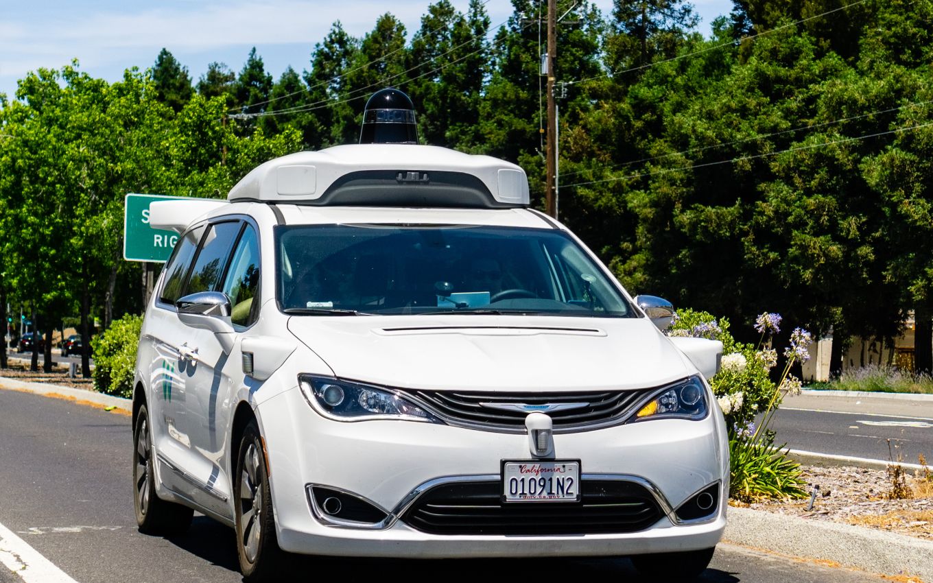
This phase of development is already underway in the West, with self-driving cars and autonomous vehicle (AV) technology growing at a much faster pace than expected earlier. As the new breed of vehicles and transportation systems will drive the future of mapping services and software, India’s guidelines regarding this sector are critical for startups.
To complete the video game analogy, we are going from 2D PAC-MAN to 3D Wolfenstein.
Why India Wants Control Of Next-Gen Mapping
For years, India has rigidly regulated the areas of mapping, ground surveillance and geolocation data through strict laws, but the authorities have been less than stringent in enforcing the law. The Survey Of India said in 2017 that Google Maps was not authentic or accurate. The agency claimed that Google Maps was not approved by the government and, therefore, unfit for official use. In 2020, the same government agency called for an end of Google Maps’ predominance among third-party service providers and end consumers of mapping services.
However, these noises did not change anything for Google Maps or other international applications in this category.
Despite tight controls over who can conduct mapping exercises, to what degree and what can be mapped in India, global tech giants still dominate this space although homegrown companies like MapmyIndia and other solution providers are trying to make inroads. However, big tech companies such as Google, HERE (formerly owned by Nokia and Microsoft) and Apple have always been at the forefront of this category’s most visible innovations.
In a bid to take on Google Maps and other consumer-focussed mapping apps, Delhi-based GPS navigation company MapmyIndia recently announced a strategic partnership with ISRO to launch mapping portals, apps and geospatial services. Other companies are similarly bullish.
“Until now, Indian tech startups had to compete with international biggies for innovating in this space. Plus, there were accessibility challenges in our own country. But the deregulation of geospatial data for Indians gives the native IT industry huge leverage over international players with a virtual monopoly on data-driven services across the world. Today, there is a chance to create a Google in India,” Rajit Bhattacharya, CEO of location intelligence services startup Data Sutram, told Inc42.
Kolkata-based Data Sutram plans to extend its existing data partnerships with businesses so that its data can be utilised in developing actionable insights for several industries. “With more than 250 data partnerships in place, companies can also monetise their data by aggregating it at location levels,” the CEO added.
Like Data Sutram, Bengaluru-based Locus also works with location intelligence and geospatial data, helping businesses gain insights into their operational parameters. Locus, which works with hyperlocal delivery firms, ecommerce companies and other logistics businesses, believes that homegrown solutions will make more financial sense for startups. “The liberalisation of mapping is a game-changer, particularly for companies like Locus, specializing in creating advanced routing solutions. Now there will be far greater visibility on the country’s fast-changing “Points of Interest” data and connectivity infrastructure. Also, the procurement or usage of such information can be a lot more straightforward,” the company’s chief data scientist Shantanu Bhattacharrya said.
Incidentally, the Department of Science and Technology (under the Ministry of Science and Technology in India) will be the single point of contact for acquiring geospatial data. These guidelines will apply to geospatial data, maps, products, solutions and services, all the critical components of next-generation mobility, as we will see.
The Future Is Driverless, But There Are Challenges Galore
The global trend is quite clear nowadays as developed countries like the US and several European nations are shifting their focus to driverless cars. In contrast, India is still hesitating to embrace the next mobility revolution. Of course, connectivity and road conditions are major issues here, but there is also a lack of geospatial data at street levels. If companies have to bring self-driving technology to India, the biggest challenge will be the lack of street-level data.
With the new guidelines in place, the Indian government is looking to prioritise the involvement of Indian companies, startups and geospatial service providers in the next phase of mapping through advanced technologies like LiDAR, 360-degree cameras, on-ground sensors and beacons, and drone-based surveillance, which will back the existing and constantly improving satellite imagery. Therefore, Indian companies in the geospatial domain need to focus their efforts on this space.
The guidelines state that any geospatial technology such as “aerial/UAV photogrammetry, aerial/UAV LiDAR, drones, radar interferometry, street view or other means of ground surveys, satellite-based remote-sensing techniques, AI, underwater mapping and others” will be covered under the new rules on how foreign mapping services can operate in India.


As of now, even Indian startups use the APIs provided by Google, HERE Maps, OpenStreetMaps and other international services for location-based data in ecommerce, logistics, hyperlocal delivery or transport operations. In fact, the onus seems to be on these tech behemoths to improve digital maps and geolocation services in India. But given the unique and unplanned nature of many Indian cities, it has been quite challenging to map out every inch — even though Google has tried it with its Street View car. “Google’s geocoding API (used to find latitude and longitude for addresses) has its challenges when it comes to interpreting Indian addresses as there are language complexities,” said Bhattacharya of Data Sutram.
Anyone who has tried to find their way through bylanes and alleyways would know the intricacies of Indian streets. With next-gen mapping technologies, such limitations are expected to be tackled easily.
Logistics tech startups have been grappling with this issue for years. They know that data accuracy is a challenge and providing location intelligence to businesses will be more effective when data accuracy improves. The likes of Locus, LogiNext, Shiprocket and others are looking forward to the new reality when they can drive innovations more directly.
“Regions with defined mapping are able to enjoy a strategic advantage over other nations, which enables them to move forward in various areas of operations because of this visibility,” said Dhruvil Sanghvi, cofounder and CEO of LogiNext, a logistics tech company.
“Until now, not having access to geospatial data, which was highly restricted, hampered innovations within the sector. With the new policy changes, startups can now work on technologies and build systems which can be deployed among mainstream operations. This availability now makes it easier for us as well as other companies to utilise the information and drive innovative solutions,” he added.
Trailing In The Autonomous Vehicle Race
Although Infosys introduced India’s first indigenous driverless car in 2017, most applications in this space have been developed for industrial or agricultural purposes. In contrast, global giants like Tesla, Audi, Google’s Waymo, Apple Ford, BMW, Nissan, Toyota and Uber are working on driverless vehicles.
As per reports, the global self-driving car market is expected to cross $65.3 Bn by 2027. And a key component of the autonomous vehicle market is that the major players mentioned above create and build their platforms on proprietary geospatial data. But this will become trickier in the future in India, given the guidelines.
“Indian entities, whether in government or outside, will be free to acquire, collect, generate, prepare, disseminate, store, share, publish, distribute, update, digitise and/or create geospatial data, including maps, of any spatial accuracy within the territory of India, including underwater, within its territorial waters, by using any geospatial technology, subject to regulations on attributes in the negative lists,” the guidelines state.
The government has further mandated that foreign companies or companies in India with overseas holding companies will need to license geospatial data from such Indian entities. This means Indian companies need to double down on innovations in this field to support the high-tech operations and ambitions of next-generation transportation systems and auto companies.
Currently, the reality seems different. In India, the likes of Tata Elxsi (a product design and technology firm of the Tata group) have stopped testing AV solutions as the demand for such innovations has gone down among car-makers. Former Tata Elxsi CEO, Madhukar Dev, said in 2019, “The need for full autonomy seems to have disappeared for the moment and what is coming in is assisted driving.”
Tata Elxsi is reportedly licensing its assisted driving solution instead of fully autonomous cars. The difference between the two: The former keeps the human driver in complete control of the car with some assistance in power delivery and guidance while AVs are entirely self-reliant and manual interventions are only needed in emergencies.
A Booster Shot For India’s Geospatial Innovations
Nevertheless, AV solutions do exist in India. Mumbai-based AutoNxt Automation, which has developed a driverless electric tractor for farm operations, is looking forward to contributing more directly to the geospatial data pool now that the guidelines are in place. Founder and CEO Kaustubh Dhonde told Inc42 that earlier, the company used to rely on third-party systems such as GPS or GLONASS (Global Navigation Satellite System) as well as APIs from location services providers for its geofenced autonomous tractors.
“With the new guidelines, we won’t have to use a geofence as the accuracy can be as good as 10m. We had already been working with systems like Radar and LiDAR and IoT sensors for our autonomous platform. But India badly needed this push for geospatial data.”
According to Dhonde, India is a couple of years late on these guidelines, but welcomed them nevertheless. “We have been waiting for something like this since 2018, and it will allow companies to participate more directly.”
He also pointed out that licensing satellite data from providers worldwide can be cost-intensive for startups compared to using internal hardware systems such as smart cameras and Radar antennas and more.
Simply put, LiDAR is a remote-sensing method that uses light in the form of a pulsed laser to measure ranges (variable distances) to the earth’s surface from a given point. It is said to generate precise 3D information about the shape of the earth and its surface characteristics such as buildings, depressions and topography. This will be especially useful for autonomous vehicle platforms.
A LiDAR instrument consists of a laser, a scanner and a specialised GPS receiver. This can be outfitted on a vehicle, a drone or even a smartphone or a tablet like the Apple iPad Pro, released in 2020. As Apple puts it, “The LiDAR scanner measures the distance to surrounding objects up to 5 metres away, works both indoors and outdoors, and operates at the photon level at nano-second speeds.”
Not only is the accuracy of data improving by a magnitude, but the cost of innovation is also going down. For companies like AutoNxt and others developing autonomous platforms based on location intelligence, this is a huge win-win. But Dhonde did warn that some companies, which mainly rely on third-party providers, would have to bear the initial cost of moving to hardware-based mapping.
Moreover, the new guidelines usher in a brave new world where companies can look beyond single applications. AutoNxt is looking at industries and warehouses besides agriculture for its autonomous tractors. Dhonde also mentioned that the increasing data accuracy would do away with limited-scope applications.
Bhattacharya of Data Sutram also hinted at how the guidelines would change the ground reality across industries. “Geospatial data plays a crucial role in developing primary sectors like financial services, agritech, pharma and healthcare, logistics and ecommerce. It is also essential for smart city planning or developing several other sectors across the board. But there is a huge lack of relevant data needed for this purpose. Hence, there is a need for mapping data with high accuracy.”
The scenario is changing, though. Tesla’s high-profile entry into the country is just the beginning. With the world’s most valuable auto company coming in, others are bound to consider India and thus galvanise the ecosystem. These companies will arrive with serious tech chops to implement their vision in this space. But many of them could be pondering a thing or two, given the government’s guidelines.
The latest guidelines for the geolocation and mapping industry might be a deterrent to some international players. But it is also one way to ensure a level playing field for Indian companies and not let their advantage in technological capability slip away as had happened in the past.