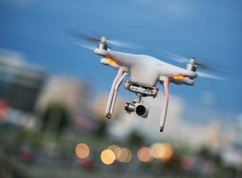
With Drone technology, the Drone Service Providers (DSPs), have already mapped the entire city of Jaipur
If BIM Methodology is the book, Drones would be the typewriter
True game changer would be Beyond Visual Line of Sight (BVLOS) approval
Inc42 Daily Brief
Stay Ahead With Daily News & Analysis on India’s Tech & Startup Economy
Infrastructure Industry has been ripe for disruption. Somehow from Banking to Food to Music, everything came online except Infrastructure. India holds pages and pages of data lying at the desks of even the most technologically advanced construction firms. Be it Pipelines, or Trains, or Highways or Mines, the procedure is the same.
The engineering drawings for many of our important Railway stations have been lying between files and there is no quick access to view them if an emergency was to come up.
In such a scenario, it has been observed that the following sectors along with a few others have come up with their own intriguing stories. The story of India and its Drones.
Smart City Planning
With Drone technology, the Drone Service Providers (DSPs), have already mapped the entire city of Jaipur complete with facade reconstruction showing each and every window. This combined with the correct array of CCTVs means VIP movement planning requires much less time and much fewer security men holding guns.
Railways
We see many important projects that the Railway Minister Piyush Goyal has taken up aggressively. These projects (mentioned below) will demand a lot of push from the DSPs.
- Rail Electrification
- Project Unigauge
- Dedicated Freight Corridor
- Level Crossings Elimination
Here’s a brief of how Railways is pushing aggressively on the aforementioned projects.
As of now, out of 67,368 km of railway track, 37,156 km of rail lines run on diesel that amounts to about INR 13,510 Cr per annum extra in fuel costs. However, by 2021, the government wants to achieve 100% rail electrification. No more costly diesel trains.
This presents a large opportunity to pick up rail electrification tenders, construct electrified poles and many of Indshine’s clients like KEC, Kalpataru have dived head first into railway electrification and have turned to a faster mode of surveying that drones provide, instead of doing it manually and delaying the entire project.
Project Unigauge incorporates converting all narrow and metre gauges into broad gauge so we can connect everything with one locomotive and one kind of track.
When you convert a gauge from narrow gauge to broad gauge, you need to change curve alignment and acquire new lands. Piyush Goyal, in the FICCI Conference held in Delhi this August, rightfully pointed out that India has a history of delaying land acquisitions by multiple years, and hence the land prices go up leading to a huge loss of capital. When we survey the land faster, everything changes.
Level crossings are the intersection of railway lines and roads with barriers to traffic when a train passes. They account for a staggering 65% of total deaths due to train accidents, which makes this project really dear to India.
Highways
In February, the Ministry of Statistics and Programme Implementation monitored infrastructure projects worth INR 1.5 Bn and above.
“Total original cost of implementation of the 1,304 projects was INR 16.21 Tn and their anticipated completion cost is likely to be INR 18.38 Tn, which reflects overall cost overruns of Rs 2.16 trillion (13.36% of original cost),” the ministry’s latest report for February 2018 said.
It has also been observed that “project agencies are not reporting revised cost estimates and commissioning schedules for many projects, which suggests that time/cost overrun figures are underreported”, according to the report.
We lose a huge sum of money to this lack of planning and monitoring. Regular billing of earthwork, Enterprise Resource Planning (ERP) and Building Information Modelling (BIM) has been nothing but a theoretical subject for decades. How can we make it come to life?
If BIM Methodology is the book, Drones would be the typewriter. Drones are the only medium to convert all that field data into digital models for engineers in offices to view, measure and monitor. This is the only route to bring ERP, BIM and scheduling under one roof. There is an amazing opportunity here to completely change the way Infrastructure Industry works and to bring it a digital renaissance.
We are proud to say that NHAI has taken a cue from this, and has made BIM mandatory for all important projects such as the Nagpur-Mumbai Super Communication Expressway.
Forestry
Shimla faces large-scale illegal tree felling of Deodar Trees. When even the Aryabhatta Geo-informatics & Space Application Centre (AGiSAC) was unable to solve this issue, they turned to Drones and Indshine was given the challenge.
We re-engineered the gimbal of our drone to make the huge terrain climb possible and through computer vision algorithm, we were able to count the exact number of trees in Jakhu Ward of Shimla and by tightening the security in that precise area, Deodar trees were saved.
India’s DSPs have their hands into Mining, Industrial Inspection of 65m tall Transmission Towers, Insurance, Disaster Relief, Agriculture and in my opinion, we haven’t even scratched the surface yet.
Suggestions for Drone Regulations 2.0
In Drone Regulations 2.0, we look forward to India incorporating MoHA under the digital sky platform so we don’t have to seek permission from MoHA separately.
NPNT rules will have to incorporate simultaneous flights. We also hope that Swarm of Drones would be allowed.
True game changer would be Beyond Visual Line of Sight (BVLOS) approval.
Droppable payload like spraying in agriculture, seeds etc and delivery of goods is another place where India has taken a conservative stand and it would need to change.
{{#name}}{{name}}{{/name}}{{^name}}-{{/name}}
{{#description}}{{description}}...{{/description}}{{^description}}-{{/description}}
Note: We at Inc42 take our ethics very seriously. More information about it can be found here.


