The policy was approved at a meeting chaired by Prime Minister Narendra Modi
The new guidelines aim to support innovation and scale startup initiatives to bridge digital divide and capitalise on the burgeoning ecosystem
The government plans to set up incubation centres and accelerators in collaboration with the industry and other stakeholders to spur local startups
Inc42 Daily Brief
Stay Ahead With Daily News & Analysis on India’s Tech & Startup Economy
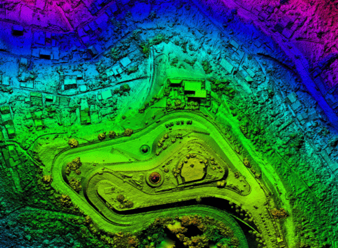
In a bid to give a major boost to India’s geospatial startup ecosystem, the Union government has notified the National Geospatial Policy, which aims to build a national framework that supports liberalisation and commercialisation of the sector.
The policy was approved by the Union cabinet at a meeting chaired by Prime Minister Narendra Modi on December 16.
The new guidelines aim to support innovation and scale startup initiatives to bridge digital divide and capitalise on the burgeoning ecosystem.
“The policy will enable and support innovation, creation and incubation of ideas and startup initiatives in the geospatial sector that will enable leapfrogging from outdated regulations, technologies and processes, bridging the Geospatial digital divide and capitalising on the opportunities arising out of continually evolving technology,” according to the notification.
The government also plans to set up ‘Geospatial Incubation Centres’ and ‘Geospatial Industry Accelerators’ in collaboration with the industry and other stakeholders to spur local startups. The centre plans to facilitate long-term contract R&D to enable the local industry to quickly scale up and build the next generation of such technologies. The norms outline vision and goals that will be implemented over the course of next 12 years.
Apart from this, the policy document also calls for the creation of a national-level apex body, Geospatial Data Promotion and Development Committee (GDPDC). This panel will be the nodal body to regulate the use of geospatial data in governance across specific ministries and to enable startups and other enterprises to work on specific projects.
The guidelines will pave the way for the development of geospatial infrastructure and standards. They are expected to promote innovation and businesses to strengthen the national and sub-national arrangements to generate and manage geospatial information.
Major goals and visions enshrined in the policy are as follows:
- To make India a world leader in global geospatial space with best in class ecosystem for innovation
- To develop a coherent national framework in the country and leverage it to move towards digital economy and improve services to citizens
- .To enable easy availability of valuable geospatial data collected utilising public funds, to businesses and general public
- To have a thriving geospatial industry in the country involving private enterprise.
Among other things, the policy envisages the development of Geospatial Knowledge Infrastructure (GKI) in the country by 2030.
Among other things, the policy will seek to promote the use of National Digital Twin, which will essentially be an ecosystem of ‘smart, dynamic, connected Digital Twins’ that will implement interoperable sharing of data to facilitate better decision-making.
Besides, the notification also outlines the development of 14 National Fundamental Sectoral Geospatial Data Themes to ramp up commercial geospatial applications in sectors such as disaster management, mining, and forestry.
The new guidelines also float the concept of registration certification for surveyors, which will be based on industry benchmarks and standards. These norms will be applicable to aerial survey professionals, drone survey professionals, geographic information system (GIS) professionals, remote sensing personnel, among others.
The government also plans to undertake measures to promote the use of geospatial technologies such as drones, synthetic aperture radar, and electromagnetic locator, among others, for survey and mapping activities in the country.
An advisory body under the name of Geospatial Industrial Development Board (GIDB) will be set up and include representatives from the Ministry of Commerce and Industry, the Department of Science and Technology and the Department of Revenue. The board will provide feedback to help spur the local geospatial ecosystem.
Overall, the space continues to be in its nascent stage and has seen the growth of a slew of new companies in the arena. These include listed startup MapMyIndia and other emerging players such as LocaleAI, SatNav, SatGuide, and Aarav Unmanned Systems, among others.
Recently, Union minister Jitendra Singh said that India’s geospatial economy is expected to cross INR 63,000 Cr by 2025 and provide employment to more than 10 Lakh people in the years to come.
{{#name}}{{name}}{{/name}}{{^name}}-{{/name}}
{{#description}}{{description}}...{{/description}}{{^description}}-{{/description}}
Note: We at Inc42 take our ethics very seriously. More information about it can be found here.


